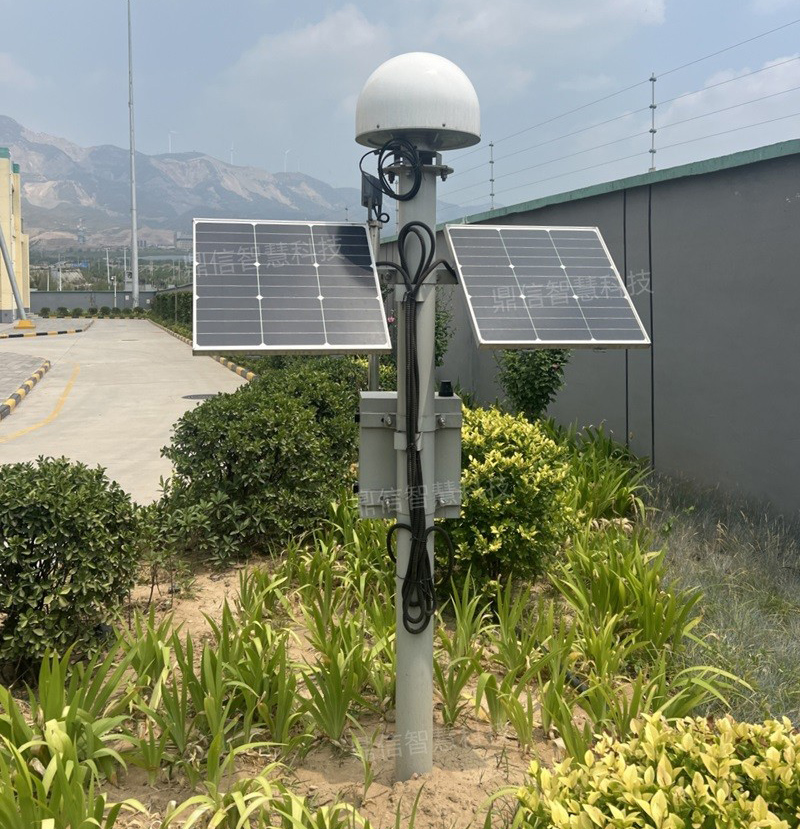
Power energy is the core power of modern social development, and in the power transmission network, the tower as an important support structure of the transmission line, but always facing challenges from the natural environment and man-made damage. Geological activities, soil erosion, extreme weather and long-term mechanical stress may lead to tower settlement, which may lead to flashover, wire breakage and other faults, and in serious cases, even cause tower accident, bringing great risks to the normal operation of the power system.
Response program: transmission line Beidou tower settlement online monitoring device
The Transmission line tower settlement online monitoring device DX-BDS100-CJ adopts BeiDou high-precision relative positioning technology, integrating Internet of Things, BeiDou satellite navigation, big data and intelligent data. DX-BDS100-CJ, adopting BeiDou high-precision relative positioning technology, integrating Internet of Things, BeiDou satellite navigation, big data and intelligent analysis algorithms, realizes real-time monitoring of tower settlement, which is able to warn of the potential risks in advance, and provides a strong technical support for the safe operation of power grids.
High-precision positioning, millimeter-level monitoring
Beidou satellite navigation system, as a global satellite navigation system independently developed by China, plays an important role in tower settlement monitoring by virtue of its technical advantages such as high precision, all-weather and real-time. It is not only able to provide millimeter to centimeter-level high-precision positioning services, but also has a unique short message communication function, which can realize information transmission even in the absence of signal zones and communication interruptions, and these characteristics make its monitoring ability in complex terrain and harsh environments far more than that of traditional means.
Principle of BeiDou relative positioning technology
By arranging BeiDou monitoring antennas on towers, the same BeiDou satellites are observed synchronously to determine the relative position of baseline endpoints or baseline vectors. The baseline accuracy can be improved by finding the difference of the observed quantities, which can eliminate the satellite clock difference and receiver clock difference, weaken the influence of ionosphere and troposphere refraction, and eliminate the whole-week ambiguity parameter. And the data is encrypted and transmitted to the data center, and the BeiDou data processing engine is used to carry out the baseline solving between the base station and the positioning point, to obtain the real-time three-dimensional coordinates of the tower with high accuracy, and to form the discrepancy data by comparing and analyzing the real-time displacement data, meanwhile combining with the data of BeiDou Ground-Based Enhancement Station, the positioning is upgraded to millimetre level, so as to monitor the settlement situation of the pole tower.
Monitoring accuracy
1, static accuracy: horizontal less than ± 2mm +0.5ppm, vertical less than ± 4mm +0.5ppm
2, wind load vibration monitoring accuracy: horizontal less than ± 10mm, vertical less than ± 20mm;
Technology guards against danger before it occurs
Unaffected by the climate, the Beidou transmission line Pole Tower Settlement Online Monitoring Device can realize all-weather, uninterrupted monitoring.
Online tower settlement monitoring device can realize all-weather, uninterrupted monitoring. Like a 24-hour online "intelligent security guards", always ready to deal with any unexpected situation. Once the tower settlement, deformation, tilt and other abnormalities, the system immediately through the Web, APP and short messages and other ways to push warning information to the user, not only to improve the response speed, but also effectively prevent the occurrence of accidents, disaster prevention and mitigation provides a strong guarantee. In the future, with the further development of BeiDou system and the deep integration with other technologies, its application in the field of geological disaster monitoring will be more extensive.


